

Oreilet
Land Meter Survey Meter, Handheld Surveyor Area Measuring Tool GNSS with 2.4in Screen, Area Surveying Equipment Instrument for Outdoor Distance
Land Meter Survey Meter, Handheld Surveyor Area Measuring Tool GNSS with 2.4in Screen, Area Surveying Equipment Instrument for Outdoor Distance
Couldn't load pickup availability
Brand: Oreilet
Features:
- [Industrial-grade Durability] Built to withstand tough environments, the land meter adopts industrial three-proof technology, making it , , and fall-. its robust construction ensures long-lasting performance, while real-time voice broadcasting in english and large volume warnings make it usable even in noisy outdoor settings.
- [Real-time Trail Display] With a 2.4-inch high-definition black and white screen, this land measuring instrument provides a real-time view of trail graphics during use. saved data can be reviewed later, offering a comprehensive record of your measurements. the built-in barometer elevation measurement enhances height accuracy, making it ideal for detailed surveying tasks.
- [User-friendly Design] Designed for ease of use, the land meter features large buttons and a straightforward interface, ensuring quick and hasslefree . its compact and portable size makes it convenient to carry, while the long-lasting 1800mah battery ensures extended usage. whether you're a professional surveyor or a hobbyist, this tool is easy to get started with.
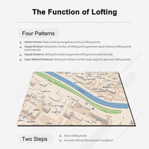
- [Versatile Measurement Modes] This handheld land survey meter supports two primary measurement modes: area measurement and distance measurement. additionally, it offers advanced functionalities like waypoint acquisition, route navigation, trail navigation, and lofting navigation. data export capabilities make it easy to transfer and analyze your measurements on other devices.
- [accuracy Gnss Technology] The land meter features a measurement-grade high-sensitivity gnss receiver chip, utilizing a six-star system for global coverage. this ensures precise and area and distance measurements, even in remote outdoor locations without mobile phone . who demand accuracy in land surveying and mapping tasks.
model number: Oreiletivxna9m7ch
Part Number: Oreiletivxna9m7ch
Details: [Real-time Trail Display] With a 2.4-inch high-definition black and white screen, this land measuring instrument provides a real-time view of trail graphics during use. saved data can be reviewed later, offering a comprehensive record of your measurements. the built-in barometer elevation measurement enhances height accuracy, making it ideal for detailed surveying tasks.
[Versatile Measurement Modes] This handheld land survey meter supports two primary measurement modes: area measurement and distance measurement. additionally, it offers advanced functionalities like waypoint acquisition, route navigation, trail navigation, and lofting navigation. data export capabilities make it easy to transfer and analyze your measurements on other devices.
[accuracy Gnss Technology] The land meter features a measurement-grade high-sensitivity gnss receiver chip, utilizing a six-star system for global coverage. this ensures precise and area and distance measurements, even in remote outdoor locations without mobile phone . who demand accuracy in land surveying and mapping tasks.
Spec:
Item Type: Land Meter
Location Time: Hot Start Time: 1 Second; Cold Start Time: 30 Seconds
Position Accuracy: Within 2 meters (HDOP value less than 1.0)
Area Accuracy: Measurement error not greater than 0.03μm (1-3μm), 2% (greater than 3μm)
Distance Accuracy: Within one meter (when HDOP value is less than 1.0, measurement length is 100 meters)
Features: Coordinate measurement, route editing, trail recording, navigation function, height measurement, area measurement, distance measurement, elevation function
Data Statistics: Area statistics, distance statistics
Area Records: 99 Waypoint records 2000
Distance Records: 99 Trail records 100
Route Records: Maximum version number of 200, up to 400 points per route
Trail Display: Real time trail display during measurement,
Package Dimensions: 5.5 x 3.1 x 2.4 inches
Share